

Every spring, when hurricane forecasters deliver good news, a certain kind of relief descends upon coastal communities. That relief arrived early this year. NOAA revealed in May that the 2026 Atlantic hurricane season was expected to be below average, largely due to a strengthening El Niño that some researchers are now calling potentially record-breaking in intensity. This was what meteorologists had been quietly anticipating for months. At a Lakeland, Florida, press conference, officials presented statistics that haven’t looked this good in years.
The headline numbers are fairly simple. Eight to fourteen named storms are predicted by NOAA, of which three to six will reach hurricane strength, and only one to three will develop into major hurricanes—those Category 3, 4, and 5 systems that have the power to alter coastlines and leave a lasting impression on future generations. That is a significant difference from the 14 named storms and 7 hurricanes that occur during an average season. By July, Colorado State University, which has been conducting its own parallel forecasting operation, was even lower, predicting only four hurricanes and nine named storms. August came next, and AccuWeather also reduced its numbers. It’s important to pay attention when forecasters from rival organizations begin to lean toward the same cautious optimism.
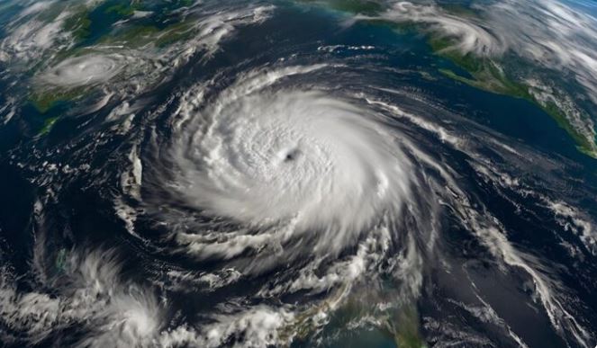
El Niño is the driving force behind all of this, and the 2026 model might be exceptional. Wind shear over the Caribbean Sea reached the second-highest level ever recorded for that time of year by July, according to climate scientists who have been monitoring its intensification since early spring. This is significant because the formation and organization of hurricanes depend on calm, humid air columns. El Niño interferes with this by forcing wind shear into the main development region, which is the vast expanse of open Atlantic that stretches from the coast of West Africa to Yucatan, Mexico, where the majority of Atlantic storms originate. In essence, it creates unfavorable conditions for storm development right when the season is meant to be at its peak.
Even so, there’s something uneasy about losing yourself in these numbers too much. In June, Tropical Storm Arthur—the season’s first visitor—made that point quite bluntly. Arthur never developed into a hurricane. It was never even close to being structured according to the criteria that forecasters find important. However, it sat over Louisiana and dumped record-breaking amounts of rain, breaking the state’s 24-hour precipitation record and creating the wettest June day ever recorded in New Orleans. While they were wading through floodwaters, people on the ground might not have given a damn about Arthur’s classification.
After releasing the May forecast, Ken Graham, Director of NOAA’s National Weather Service, stated unequivocally that it only takes one storm to create a very bad season. Every year, that phrase is repeated, and each time it sounds a bit like a disclaimer. However, Arthur did show why it is still said. The statistical profile of a season and the behavior of a single storm are fundamentally different discussions. Over a period of six months, one characterizes general atmospheric conditions. The other explains what transpires in a particular week along a particular stretch of coastline.
The outlook for the Central Pacific, however, presents an entirely different picture. There is a 70% chance of an above-normal season, according to NOAA, which serves as a reminder that El Niño’s effects are not always calming. It shifts risk rather than eliminates it by suppressing Atlantic activity while occasionally improving Pacific conditions.
Despite its positive storm totals, AccuWeather’s August update still projects three to five direct U.S. impacts for the season. Even though the overall storm count estimates have decreased, that number has remained stable. This begs the question, “What exactly does a ‘quiet’ season feel like to someone standing in their path if fewer storms form but those that do manage to reach American coastlines?”
As this season progresses, it seems that forecasters are performing their duties effectively, incorporating drone data, AI-based weather models, and next-generation satellite imagery while being cautious not to overstate the calm. There has been a real improvement in the tools. There is genuine confidence in seasonal ranges. However, the Atlantic has always had a knack for creating the unexpected within whatever constraints the models indicate, and this year is probably not going to be any different. As Graham and others have been saying since May, preparation is still the more accurate prediction.
FAQs
Q1: What is NOAA’s overall prediction for the 2026 Atlantic hurricane season?
NOAA forecasts a below-normal season with a 55% probability due to El Niño.
Q2: How many named storms are expected in 2026?
Forecasters predict between 8 and 14 named storms this season.
Q3: Why is the 2026 hurricane season expected to be quieter than usual?
A strengthening El Niño is creating hostile wind shear conditions for storm development.
Q4: Does a below-normal season mean the U.S. coastline is safe?
AccuWeather still predicts 3 to 5 direct U.S. impacts this season.
Q5: What did Tropical Storm Arthur prove about quieter hurricane seasons?
Even weak, disorganized storms can cause historic flooding and serious damage.
